Navigate abandoned transit lines, architectural oddities, and underground culture in major cities through tested exploration routes.
Every city has layers. The tourist version shows you monuments and museums. The local version knows the good taco spots. But the explorer's version? That's where you find the abandoned subway platform under the financial district, the rooftop with sightlines across three neighborhoods, the alley where five different crews have been battling in spray paint for a decade.
These guides aren't about checking off landmarks. They're about reading the city's bones—finding the pre-war infrastructure that never got demolished, the Cold War-era fallout shelter entrances still visible if you know the architectural tells, the loading docks that become impromptu galleries after dark. I've walked these routes at different times of day because morning light hits industrial brick differently than the golden hour, and some spots only make sense when you see the commuter flow patterns. If you'd rather start after sunset, when the loading docks fill up and the murals get lit by sodium lamps, there's a whole list of side quests to do at night that pair well with these routes.
You'll need comfortable walking shoes (the kind that handle broken pavement), weather-appropriate layers, and the ability to look interested but not touristy when you're photographing something technically visible from the street but clearly not meant for public attention. The best urban exploration isn't about trespassing—it's about seeing what's already there with sharper eyes.
Why This Quest Matters
Most people see cities as flat maps of destinations. You'll learn to read them as layered texts—where the abandoned subway platform under the financial district tells the story of failed expansion plans, where spray paint battles mark territorial evolution, where architectural scars reveal what the city tried to erase. This isn't tourism; it's learning to see the skeleton beneath the skin.
What You'll Experience
How to identify historical infrastructure hidden in plain sight
The art of reading architectural transitions and material tells
Strategic timing for exploration access and lighting conditions
Building location intelligence that compounds with each visit
Seeing cities three-dimensionally instead of just at ground level
What You'll Need
Top gear to make this quest great.
Pull it off
Tactical Urban Sling Bag with MOLLE Webbing
Keeps hands free for climbing/photographing while distributing weight evenly. MOLLE system lets you customize gear arrangement. Crossbody style reads as 'messenger' not 'tourist backpack', which matters when you're shooting architecture in commercial districts.
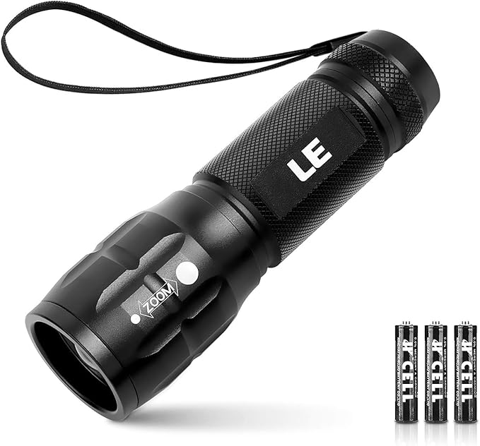
Reveals details in shadowed architectural spaces, under bridges, in recessed doorways. Essential for reading cornerstone dates, inspecting material conditions, and illuminating layered graffiti history. The adjustable beam lets you spotlight specific elements without lighting up entire structures.
Captures full building facades from narrow alleyways and tight interior spaces where you can't back up. The difference between a cramped partial shot and a usable architectural documentation photo.
As an Amazon Associate I earn from qualifying purchases. Prices may change.
Step-by-Step Guide
1
Map the city's hidden bones
Research your target city's historical development phases—industrial era, post-war expansion, urban renewal projects. Use digitized maps from city archives to identify exploration zones: pre-gentrification industrial districts, neighborhoods with mixed-era architecture, areas near decommissioned infrastructure like old rail lines or filled-in canals. Use satellite view to spot rooflines, alleyways, and spatial anomalies, then pre-scout access points with street view.
💡 Pro Tips:
• Look for material transitions where old construction meets new—these seams reveal what the city tried to hide
• Historical societies often have digitized maps showing what used to be where before demolition
2
Time your route strategically
Map a walking route and schedule it for weekday mornings between 8-11AM when foot traffic is predictable but not overwhelming. Start with permission-default spots—public infrastructure with unusual architectural features, street art districts, parks with historic ruins. Security guards are less suspicious of photographers during business hours than at dusk.
💡 Pro Tips:
• Morning light hits industrial brick differently than golden hour; some spots reward multiple visits at different times
3
Read the architectural tells
Document specific elements as you walk: window patterns, cornerstones with dates, utility access points, material transitions. Track vertical space—fire escapes, exterior stairways, elevated walkways—because cities are three-dimensional but most people only navigate at ground level. Note which loading bays are active when, where light hits during different hours, how crowds move through spaces.
💡 Pro Tips:
• That random concrete wall might be a filled-in storefront from a 1960s urban renewal project—cross-reference with historical photos
• Cold War fallout shelter entrances have specific architectural tells if you know what to look for
4
Build your location intelligence database
Create a database with coordinates, access notes, best shooting times, and risk factors for each discovery. Cross-reference your findings with historical photos and city planning documents to understand why features exist. Your second visit to a city should be smarter than your first, with layered knowledge of temporal patterns and sight lines.
Keeps hands free for climbing/photographing while distributing weight evenly. MOLLE system lets you customize gear arrangement. Crossbody style reads as 'messenger' not 'tourist backpack', which matters when you're shooting architecture in commercial districts.
Reveals details in shadowed architectural spaces, under bridges, in recessed doorways. Essential for reading cornerstone dates, inspecting material conditions, and illuminating layered graffiti history. The adjustable beam lets you spotlight specific elements without lighting up entire structures.
Compact LED flashlight with adjustable beam and USB-C charging
Captures full building facades from narrow alleyways and tight interior spaces where you can't back up. The difference between a cramped partial shot and a usable architectural documentation photo.
Professional-grade mobile lens with 18mm equivalent focal length
Lets you pre-load routes with specific waypoints (architectural oddities, optimal photo angles, exit routes) that work without cell service in subway tunnels or industrial dead zones. Track your path for future reference and identify which detours actually paid off.
Offline mapping app with custom route creation and waypoint marking
Architecture Scavenger Hunt: Decode Your City's Hidden Design Language
That building you pass every day? It's been screaming details at you that you've never noticed.
Hunt for architectural details hiding in plain sight—corbels, keystones, terra cotta faces, and century-old brickwork patterns that tell your city's real story.
Stop winging it in abandoned spaces—learn the difference between exploring safely and just getting lucky.
Learn essential urban exploration safety protocols, risk assessment, and technical skills from experienced urbex practitioners. Hands-on training for abandoned building navigation.
The best food in your city isn't on Yelp's front page—it's where rent is cheap and menus aren't in English.
Navigate your city's authentic food scene through ethnic markets, street vendors, craft breweries, and neighborhood joints that locals actually frequent.