The fox den under the parking garage sees more action than most nature reserves.
Transform overlooked city spaces into wildlife observation zones. Learn to track urban animals, create interaction points, and document biodiversity in unexpected places.
Cities pulse with animal life if you know where to look. That drainage culvert behind the shopping center? Raccoon highway. The vacant lot with overgrown shrubs? Hawk hunting ground. The storm drain grates? Entry points to an entire underground ecosystem. This quest teaches you to map wildlife corridors, set up ethical observation stations, and create temporary interaction hubs that let you document urban biodiversity without disturbing it. You'll learn to read animal signs—scat placement, scratch marks on trees, the exact angle of disturbed grass that indicates a rabbit run versus a skunk path. The best sessions happen during transition times: that 45-minute window at dawn when nocturnal animals head home and diurnal ones emerge, or dusk when the shift reverses. I've watched possums navigate power lines like tightropes, falcons dive-bomb pigeons between buildings, and coyotes trot through intersections at 5:47 AM like they're commuting. The goal isn't to feed or approach wildlife—it's to create observation points using natural cover, motion-activated documentation, and patient stillness. You'll identify high-traffic zones, understand seasonal migration patterns through your neighborhood, and build a personal wildlife database that reveals how nature adapts to concrete. The red-tailed hawk that perches on the cell tower every Tuesday at 4 PM isn't random—it's hunting the rats that emerge when the bakery dumpsters get serviced.
You'll discover your city operates as a functioning ecosystem with commute schedules, hunting grounds, and highways invisible to most residents. That red-tailed hawk on the cell tower every Tuesday at 4 PM is hunting rats timed to the bakery's dumpster service. Once you see these patterns, every street corner becomes a page in an ongoing wildlife story you're learning to read.
Top gear to make this quest great.

Captures animal activity when you're not present. Reveals nocturnal patterns, species you'd never see during daytime visits, and exact timing of wildlife corridors. Essential for documenting shy or rare urban species.

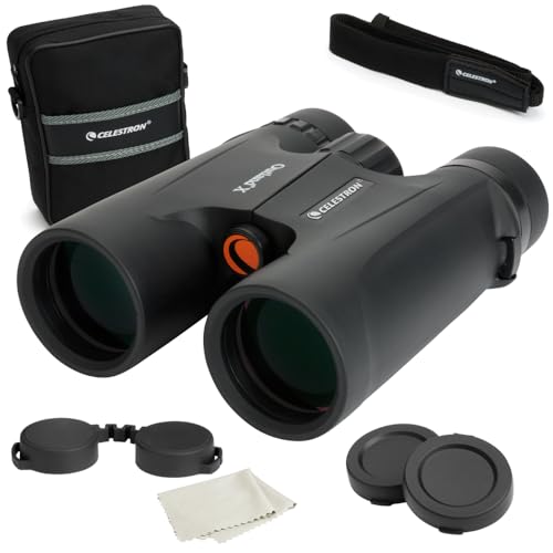
Lets you observe wildlife behavior from safe distances without disturbing animals. The close focus capability is crucial for urban environments where you might spot a bird 15 feet away, not 50 yards. Quality optics reveal behavioral details like feeding patterns and social interactions.

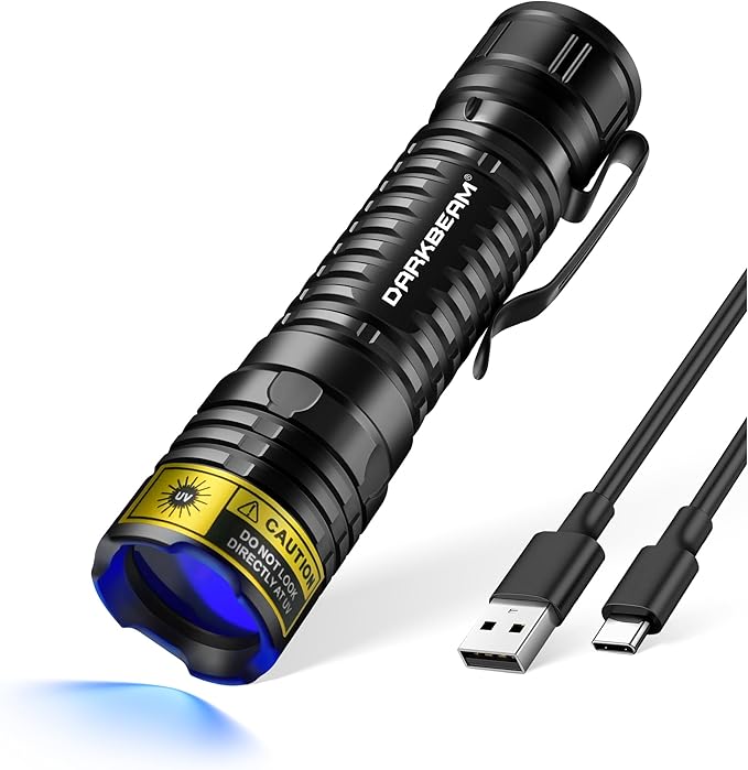
Rodent urine glows under UV light, revealing invisible trails that map prey movement through your area. These trails predict where predators hunt. Also shows scorpions (in applicable regions) and certain fungi. Game-changer for understanding the hidden food web.
As an Amazon Associate I earn from qualifying purchases. Prices may change.
Visit your zone at 5:30-7 AM, midday, and one hour before sunset. Document water sources, food availability, shelter spots, and travel corridors. Search for tracks in mud, scat, feathers, fur tufts, and digging patterns that reveal who's using this space.
Within one mile, mark green corridors (parks, railways, creek beds), transitional zones (parking lot edges, vegetated alleyways), and vertical spaces (building ledges, utility poles). Each habitat type attracts different species and movement patterns.
Position yourself at the highest-activity zone using existing cover—parked vehicles, dumpster enclosures, dense bushes. Stay downwind if possible. Mount your trail camera 3-4 feet high on a sturdy surface, angled slightly downward toward the corridor.
Use your UV flashlight to reveal rodent urine trails, which glow blue-white. These illuminate prey movement patterns and predict where predators will hunt. Mark these glowing highways on your map—they're the infrastructure of the urban food chain.
During dawn or dusk, scan with binoculars in layers: ground level, then mid-height (fences, low branches), then overhead. Record every sighting with time, behavior, and location. Use your bird identification app for calls from hidden sources. After 2-3 days, review trail camera footage at 2x speed and document timestamp patterns.
Place natural elements (fallen logs, rock piles, brush piles) in low-traffic public corners where permitted to create cover for small mammals. Never leave food. Visit your observation points weekly to track seasonal shifts: migratory arrivals, nesting behavior, predator appearances when rodent populations peak. Your biodiversity database grows with months of patterns.
Get everything you need to make this quest amazing.

Captures animal activity when you're not present. Reveals nocturnal patterns, species you'd never see during daytime visits, and exact timing of wildlife corridors. Essential for documenting shy or rare urban species.
Motion-activated wildlife camera with infrared night recording and weatherproof housing, 14+ megapixel resolution
Get on Amazon · $99.98
Lets you observe wildlife behavior from safe distances without disturbing animals. The close focus capability is crucial for urban environments where you might spot a bird 15 feet away, not 50 yards. Quality optics reveal behavioral details like feeding patterns and social interactions.
Mid-range binoculars with good light gathering for dawn/dusk observation, close focus under 6 feet for urban distances
Get on Amazon · $34.99
Rodent urine glows under UV light, revealing invisible trails that map prey movement through your area. These trails predict where predators hunt. Also shows scorpions (in applicable regions) and certain fungi. Game-changer for understanding the hidden food web.
Ultraviolet flashlight that reveals hidden biological traces, compact handheld model
Get on Amazon · $12.99Identifies bird species by sight, sound, or both. The Sound ID feature runs continuously, cataloging every bird call in real-time while you observe. Builds your species list automatically and teaches you to recognize calls. More powerful than generic search because it knows what's actually in your area.
AI-powered bird identification app with sound recognition, offline capability, and location-based species lists

Teaches you to read the physical evidence animals leave behind. That pile of feathers? Hawk kill. Those parallel scratches on the tree bark? Raccoon climbing route. The scattered nutshells? Squirrel midden. Transforms random debris into a readable story of who's living where.
Regional guide covering tracks, scat, feeding signs, and animal behavior in urban environments
Get on Amazon · $8.34RELATED GEAR GUIDE
Day Hike Gear: 10 Essentials for Every Trail
Field-tested picks · Nature & Outdoors
As an Amazon Associate, IRL Sidequests earns from qualifying purchases at no extra cost to you.
Prices and availability are subject to change. The price shown at checkout on Amazon at the time of purchase will apply.
Hand-selected quests our team thinks you'll love

Your neighborhood has more species than you think—time to prove it.

Your city's wilder than you think—you just need to know where to look.

That flash of red in the oak tree isn't just background noise anymore.